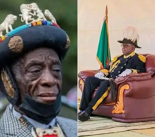
LUSAKA IS SOLI LAND. NDOLA IS LAMBA LAND. LIVINGSTONE IS LITUNGA’S- Fred M’membe

Breaking News Zambia
NewsLUSAKA IS SOLI LAND. NDOLA IS LAMBA LAND. LIVINGSTONE IS LITUNGA’S Yesterday, I asked who in this country has the lawful power to make a paramount chief, and I gave the answer the law gives. Nobody. Not the president, not a minister, and Parliament is forbidden from handing that power to anyone. Today, I want […]
LUSAKA IS SOLI LAND. NDOLA IS LAMBA LAND. LIVINGSTONE IS LITUNGA’S
Yesterday, I asked who in this country has the lawful power to make a paramount chief, and I gave the answer the law gives. Nobody. Not the president, not a minister, and Parliament is forbidden from handing that power to anyone.
Today, I want to ask the question that sits underneath it because almost nobody has asked it, and the answer settles a great deal.
Who has the power to make a chiefdom?
I will answer it in three ways. With the law as it stands. With something President Michael Sata did in 2011 that every one of us watched. And with two places every Zambian knows, Lusaka and Ndola, where we already apply the answer without ever having to be told it.
Start with what a president can lawfully do because he can do a great deal.
We have an Act of Parliament for this. The Provincial and District Boundaries Act, Chapter 286 of the Laws of Zambia. Its whole purpose is to divide this Republic into provinces and districts, to describe their boundaries, and to give them names. Under Section 2 of that Act, the President may by statutory order divide the Republic into provinces and divide those provinces into districts, as may be convenient for the purposes of administration.
That power is real. It is wide, and it is used. A president signs a statutory instrument, a line moves on a map, a new boma is opened, and a new district exists. Provinces and districts can be created. They can be altered. They can be renamed. They can be abolished.
Now let me show you the limit of that power, using an example every Zambian remembers.
In 2011, after the elections, President Sata created Muchinga Province. He did it by statutory instrument, exactly as the Act allows. Chinsali, Isoka, Mafinga, Mpika, and Nakonde were taken out of Northern Province. Chama was taken out of Eastern Province. A tenth province appeared on the map of Zambia where there had been nine. New districts followed. New offices, new officers, new budget lines.
Now tell me which chiefdom moved.
Not one. Not a single chiefdom was created by that instrument. None was abolished by it, and not one chiefdom boundary shifted by so much as a footpath. No chief woke up that morning with villages he had not had the night before, and no chief lost any. The chiefdoms of Chinsali and Chama are today exactly where they were in 2010 and exactly where they were in 1960.
Why? Because the instrument that created Muchinga had no power whatsoever over chiefdoms, and there is no other instrument in our law that does.
Go and look for the Act that lets a president create a chiefdom. There isn’t one. There has never been one. No law of this country empowers the President of the Republic of Zambia to create a chiefdom or a chieftainship, to install a chief or a chieftainess, to move the boundary of a chiefdom, to merge two chiefdoms, or to abolish one.
And the small power that once existed over the office of a chief, as distinct from the land of a chiefdom, has been taken from him by our own courts. In December 2019, in the case brought by Chief Mwene Mutondo Mulubisha of the Nkoya people, the Constitutional Court struck sections three to seven out of the Chiefs Act and ordered them removed from our statute book. Section three was the section that let a president recognise a man as a paramount chief, a senior chief, a chief, or a sub-chief. It is gone. Article 165 of our Constitution forbids Parliament from ever giving that power back to anybody.
So here is the position, plainly.
The president holds a pen over the administrative map of Zambia. He holds no pen at all over the traditional map.
These are two different maps of the same country, and they have never been on the same map. One is drawn for the convenience of administration and is redrawn whenever the administration finds it convenient. The other was not drawn by any government, can not be redrawn by any government, and was there before the government, before the colony and before the boundary.
And here is the thing that should end this argument, because we already know this, all of us, and we apply it every day without thinking about it.
Consider Lusaka.
Lusaka is the capital city of this Republic. It has a City Council, a Provincial Minister, a Provincial Administration. It is the most urbanised place in Zambia. And Lusaka stands, traditionally, on Soli land, under Senior Chieftainess Nkomeshya Mukamambo II, whose chiefdom takes in the City of Lusaka itself along with Chongwe, Kafue, Chilanga and Shibuyunji.
Nobody in this country finds that confusing. Nobody says that because Lusaka has tarmac and traffic lights and a mayor, the Soli have ceased to be its traditional owners. Nobody says that because the city is administered by the state, the chieftainess has no standing there. When she goes to court over land in her chiefdom, as she has, nobody calls it a tribal claim. We all understand the position instinctively. Lusaka is administered by the Republic, and it remains, traditionally, Soli territory.
Consider the Copperbelt.
Ndola, Kitwe, Luanshya, Mufulira. Mines, smelters, railways, a hundred years of urban settlement. All of it stands on Lamba land, under Senior Chief Mushili and the other Lamba chiefs. The Lamba do not run the mines and have never claimed to. But no one seriously argues that because a shaft was sunk and a town grew, Lambaland stopped existing underneath it.
So, we already hold the principle. We hold it for Lusaka, and we hold it for the Copperbelt. Urbanisation does not extinguish a chiefdom. Administrative reassignment does not extinguish a chiefdom. A town growing on top of traditional land does not turn traditional land into something else.
Now apply to Livingstone, the rule you already applied to Lusaka and to Ndola.
Livingstone was urbanised early, and it was placed, administratively, outside Litunga’s reach. I do not dispute either of those facts, and nothing turns on disputing them. Livingstone is administered from Southern Province, and it should carry on being administered from wherever the State finds convenient. That is not the question. The question is whose traditional territory it is, and on that, the record is not ambiguous.
Livingstone was laid out as a town in 1905, and in that original plan, the central block of the new township was set aside as public open ground and given a name. It was called the Barotse Centre, and generations knew it as Barotse Gardens. It was where our people gathered when the town itself was reserved for settlers. It was a labour recruitment ground and a parade ground. In the 1990s, long after independence, it was quietly renamed Mukuni Park.
From 1907 to 1911, Livingstone was the capital city of a territory, and that territory’s name was Barotziland–North-Western Rhodesia. Before Livingstone, the capital of the same territory was Kalomo.
The force that policed that territory until the amalgamation of 1911 was the Barotse Native Police. Its band paraded and performed in those same gardens, and when the Barotse Native Police was folded into the Northern Rhodesia Police, the band went with it.
You do not name a colonial capital’s central square, its police force, and its band after a kingdom with no standing in that place. The colonisers were not sentimental people. They named those things Barotse because that is what they found when they arrived, and because that is who they had signed with.
What happened afterwards is not a mystery either. Successive administrations moved the lines. Machile went across to Southern Province in 1909. Other areas followed, piece by piece, until a kingdom that had reached from the Kwito in the west to the Kafue in the east and down to the Chobe in the south had been reduced on paper to a province. Then our own government finished the work. In October 1969, by the Constitution (Amendment) Act Number 33, the Barotseland Agreement of 1964 was abrogated, and Barotseland was renamed Western Province. That was done unilaterally. It was done to our people, not agreed with them.
Somebody will now tell me that the Barotseland Agreement of 1964 itself makes no mention of Livingstone. That is quite true, and it does not assist them in the slightest. The Agreement of 1964 recorded what was left by 1964. It was not a survey of what had been there in 1899, and a man who signs for what remains has not, thereby, surrendered what was already taken from him. In any case, the Agreement was an instrument of administration between a government and a kingdom, and the whole of my argument is that instruments of administration have never governed the traditional map. What is true of Muchinga in 2011 is true of 1964 and of 1969.
And mark that because everyone arguing about 1964 has missed it. Every one of those acts reached the administrative map and only the administrative map. Not one of them reached, or could reach, the traditional map, for the same reason that Muchinga did not move a single chiefdom in 2011. No president of this Republic has ever held that power. All they were ever moving was the administration.
So Livingstone and the areas around it, which fell under the Barotse jurisdiction, remain under that jurisdiction traditionally, whatever province a statutory order has since placed them in. And if Livingstone and Kazungula are traditionally Litunga’s territory, I can not see how Chief Mukuni is to be made a paramount chief inside them.
It is time the Barotse Royal Establishment asserted its traditional authority over Livingstone and the areas around it. And let it assert it in the proper way, through the record and through the customs of the people, not by petition to a President, because that is a road that leads back into the colonial filing cabinet I described yesterday.
Now I know what will be said about me for saying this, so let me deal with it before it is said.
It will be said that I am setting one people against another. Look again at what I have actually argued. The rule I am applying to Livingstone is the rule this country already applies to the Soli in Lusaka and to the Lamba on the Copperbelt. If it is tribalism to say that Livingstone is traditionally Barotse, then it is tribalism to say that Lusaka is traditionally Soli, and nobody in this country has ever thought so.
Barotseland was never the private property of one tribe. The royal family is the proof. Our royal histories record that King Lewanika I had forty-four children by different wives and that those wives came from different peoples in different parts of his kingdom. That was not appetite. It was statecraft: every marriage tied another community into the kingdom. A great many of those mothers were Toka, from the very area we are discussing. As the genealogies are told, Beene was Toka and came to Lealui directly from the Musokotwane royal house, and after Lewanika became Litunga, she was his most senior wife. Her son Makweti was sent to Lovedale, came home to teach at the Barotse National School, and rose to be Natamoyo. The mother of Mwendaweli was Toka. The mother of Mbikusita Lewanika was Toka. Mbikusita was Litunga from 1968 to 1977.
And the traffic went both ways. Beene came to Lealui with her brother, and that brother was sent on to Libonda and settled with land in Liuwa. From his line descend the grandparents o Zambia’s current finance minister Dr Situmbeko Musokotwane, of the late Speaker of the National Assembly Amusaa Mwanamwambwa, and of his brother the retired Deputy Chief Justice Marvin Mwanamwambwa. Look at what that means today. A Musokotwane sits in Parliament for Liuwa. The Toka blood went north into Lealui, and the Barotse blood came south into Toka country, and it has been going both ways for a hundred and fifty years.
So do not tell me this is Lozi against Toka or Lozi against Leya. It is one family arguing about a map somebody else drew.
I said yesterday that the dignity of a chief was never in the ranking. It was always in the people, and I meant it. Chief Mukuni is an old and honoured institution, and the Leya have been on that stretch of the Zambezi for centuries. Nothing in this statement takes a single day of that away from them.
What I am refusing is something else. I am refusing the idea that a line drawn for the convenience of administration can quietly become a title deed over other people’s heritage. That is how Barotse Gardens became Mukuni Park. That is how a kingdom became a province.
The matter of Chief Mukuni’s classification is before the Constitutional Court, and I do not presume its ruling. But the question of where our chiefdoms actually begin and end is not a matter for any court, any president, or any statutory order. It is a matter for the people whose chiefdoms they are, settled honestly, and settled historically.
That is the work this country has been avoiding for sixty years. It is time we did it.
Fred M’membe
President of the SP S




Community Feedback